Positioning the Lake
Jim Sofonia from Traverse City,
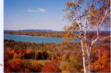
Michigan, asked, “Can you explain why some lakes are Name Lake, and others are Lake Name? Examples include Lime Lake and Lake Ann.”
Generally, larger lakes tend to have
the word lake first: Lake Michigan,
Lake Superior, Lake Ontario, etc. Smaller lakes tend to have it last: Little
Traverse Lake, Green Lake, Duck Lake. But it’s not totally uniform: Lake
Macatawa, Lake Bellaire, and Lake Cadillac are not part of the Great Lakes.
Also, if the lake name came into English from the French, the word lake is
likely to be in the first position.
The same question came up five years
ago, and I think that a portion of that answer is worth repeating.
* * * * *
I decided to go to those who know: the
U.S. Geological Survey. They forwarded my inquiry to the Geographic Names
Office, and they were kind enough to reply.
“Actually, there is no rule in the
geographic naming process that determines whether the generic term appears in
position one or position two (before or after the specific part of the name).
This is true for Lake as well; it can appear first as in Lake Superior or last
as in Great Salt Lake. We can comment that it seems more often than not that
the generic Lake seems to appear in position one for very large bodies of
water, but as in the example above, this cannot be presumed, and we reiterate,
there is no rule.”
I also asked whether the naming process
might simply depend on the whim of the cartographer. This elicited an emphatic
denial:
“Regarding whether it is ‘simply the
whim of the map maker who names it,’ we can say with authority and certainty
that it is definitely not. Firstly, map makers (and more specifically map
editors) do not ever name anything—at least those making maps or charts for the
Federal government and also those who do so for State and local
jurisdictions—although occasionally local authorities might not be aware fully
of the existing procedures. It is, in fact, the interdepartmental United States
Board on Geographic Names (the first - 1890 - of now almost 50 such
organizations worldwide) that is the sole authority for the Federal Government
of the United States regarding approval of geographic names and their
application on products of the Federal Government, both conventional and
digital.
Further, the States and local
jurisdictions generally follow the lead and policies of the U.S. Board (as do
most commercial map makers). All 50 States plus the two Commonwealths and the
three Territories have what are generically referenced as State Names
Authorities, each of which works closely with the U.S. Board to standardize
(not regulate) geographic names.
An example of non-regulation is that there is
no rule to determine whether the generic Lake appears in position one or
position two. In the United States, the policy of paramount importance is that
of local use and acceptance, so it is usually determined by perception and
recommendation from local governments and quasi-official organizations as well
as the various State Names Authorities. Other countries have other problems,
and therefore may have requirements regarding standardizing geographic name
usage.”
For Lou Yost
Manager of the Geonames Database
Manager of the Geonames Database
Listen to Mike’s program in real
time every Tuesday morning, 9:10 - 10:00 a.m. EST, by going to wtcmradio.com
and clicking on Listen Now. You’ll
also find about a month’s worth of podcasts there under The Ron Jolly Show.


Comments